Blocky Landscapes
We have long known how to read geologic structure from aerial imagery; for example, folds in layered rock generate trains of hogbacks. Yet, while the evolution of soil-mantled, convex-upward hillslopes in uniform lithology is reasonably well understood, the influence of heterogeneous lithology and geologic structure on hillslope form and evolution has yet to be properly addressed at a process level. Rocky hillslopes dotted with boulder-sized blocks and covered by a thin, non-uniform soil are common in both steep landscapes and arid environments on Earth, as well as on other planets. We’re using a combination of numerical modeling and fieldwork to ask: What roles do these blocks play in landscape evolution? See our recent review paper for a lot more info!
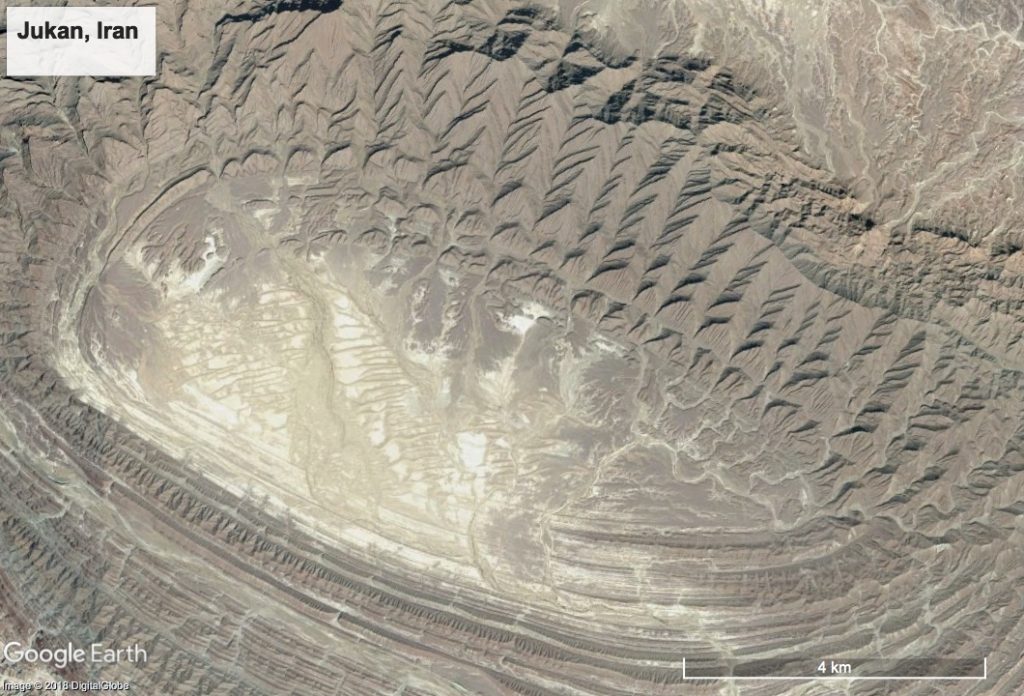
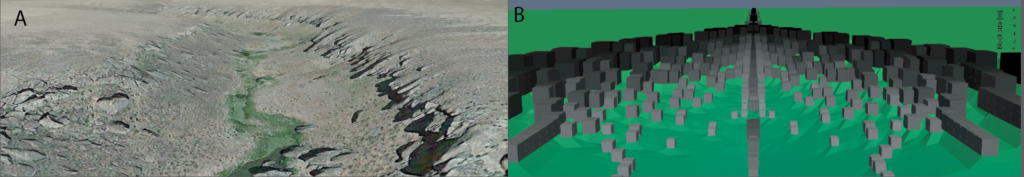
An exposed syncline illustrates large-scale topographic signatures of lithology and geologic structure. But how do landscapes like this evolve at Earth’s surface?
Hillslope evolution in layered landscapes
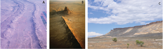
Many landscapes on Earth are developed in layered sedimentary or igneous rock. These landscapes feature sharp-edged landforms such as mesas and hogbacks that exhibit steep, linear to concave-upward ramps with scattered blocks calved from resistant rock layers overlying softer strata. This concave-up morphology contradicts current geomorphic theory, which predicts the development of convex-up or linear hillslopes.
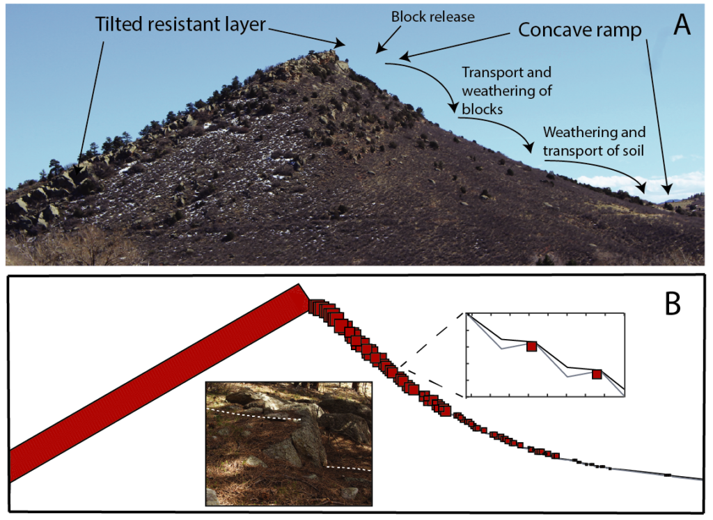
I. Why are Hogbacks Concave?
We developed a one-dimensional numerical model of a hogback to explore how layered hillslopes change over time. This work showed that the presence of discrete blocks and their interactions with the production and transport of soil can explain the characteristic concave-up hillslope profiles observed in landscapes developed in layered rock on Earth. The presence of blocks increases both the relief and the persistence of topography in these settings, fundamentally altering the pace and style of landscape evolution over long timescales. Click here for more information about this work, and here to see a video of the model.
II. Quasi-steady evolution of hillslopes in layered landscapes
A surprising result emerged from our numerical model- hillslopes reached a quasi-steady state over time, in which slope length, relief, and morphology remain constant! In order to understand this behavior, we developed an analytical framework that characterizes the general steady-state form of layered hillslopes in horizontal, tilted, and vertical rock and found that weathering and transport processes in the presence of blocks lead to self-organization that allows hillslopes to maintain a steady relief and form through time. Click here for more information about this work.
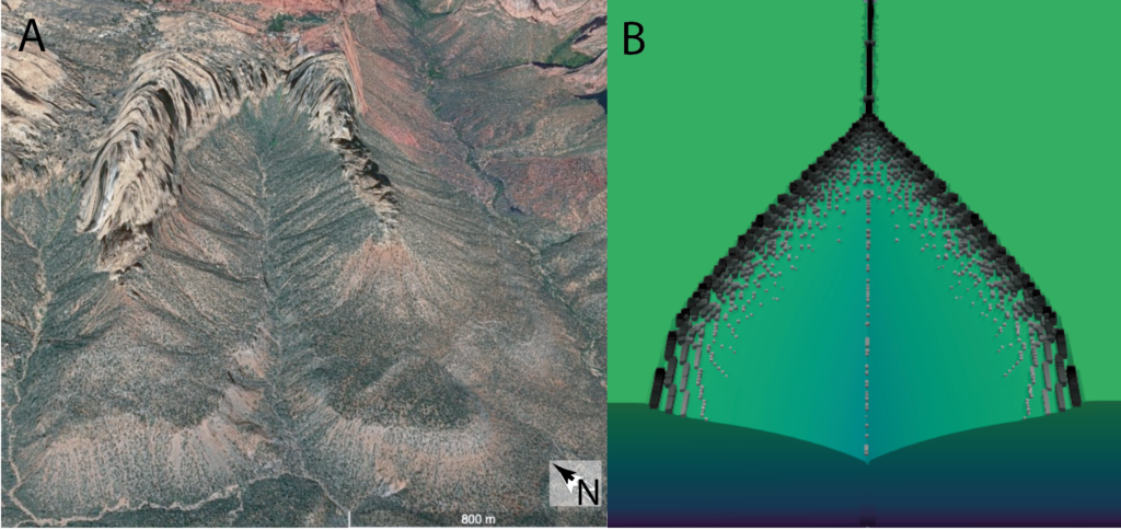
River canyon shape and erosion dynamics
In most landscapes, hillslopes and rivers are directly connected. Hillslopes deliver sediment to river channels, and rivers set the boundary conditions for their adjoining hillslopes. River canyons are perhaps the most striking examples of the channel-hillslope connection, especially in layered landscapes where resistant rock layers deliver large blocks that are often too big for the river to carry. How do these big blocks affect canyon evolution and morphology?
To answer this, we developed a process-based 2D numerical model of river canyon evolution, Blocklab, that incorporates the roles of blocks in both hillslope and channel processes. The model reveals that channel-hillslope feedbacks driven by the delivery of large blocks from hillslopes to the channel are necessary and sufficient to develop the cross-sectional and bell-shaped planview morphologies of river canyons observed on Earth. Block feedbacks lead to persistent unsteadiness in the landscape, strongly modifying erosion rates over long periods of time, even under steady forcing conditions. Click here for more information about this work.